
DJI P4 Multispectral Drone
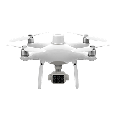
| DJI P4 Multispectral Drone | |
|---|---|
| Location: | Gab. 1.86 Building 7 |
| Manager: | Susana Costas |
| Operator: | User |
| Operating Principle: | Remote Control Drone |
| Manufacturer: | DJI |
| Model: | P4 Multispectral |
| Type: | Drone |
| Website: | DJI |
DJI P4 Multispectral drone, designed for RGB and multispectral image acquisition in research, environmental monitoring, agriculture, surveying, and mapping applications. The equipment integrates an RGB camera and a six-band multispectral imaging system, enabling detailed information on the spectral characteristics of surfaces and the generation of georeferenced maps and data products.
The system combines the cameras with a high-precision RTK/GNSS module, enabling the acquisition of spatially referenced data and automated surveying operations. It is particularly suitable for monitoring vegetation, habitats, coastal areas, water bodies, and other environments, as well as for studying spatial variability and changes over time.
This equipment may only be operated by a responsible person licensed to pilot drones.
Main Applications
- Vegetation and habitat monitoring;
- Assessment of vegetation health and vigor;
- Mapping of coastal and terrestrial areas;
- Monitoring of environmental changes;
- Surveying of water bodies and wetlands;
- Studies of the spatial distribution of organisms or plant communities;
- Precision agriculture;
Main Advantages:
- Six integrated cameras for RGB and multispectral image acquisition;
- Five specific spectral bands for vegetation and surface characterization;
- RTK system for high-precision positioning;
- Temporal and spatial synchronization between cameras;
- Integrated sunlight sensor for compensation of lighting variations;
- Automated flight mission planning and execution;
- Data acquisition suitable for photogrammetric and GIS processing;
- Ability to generate NDVI and other spectral indices;
- High repeatability between surveys;
Technical Specifications:
| Specification | Value |
|---|---|
| Manufacturer | DJI |
| Model | P4 Multispectral |
| Weight | 1487 g |
| Diagonal Distance | 35.0 cm |
| Max. Ascent Speed | 6 m/s (Automatic mode) 5 m/s (Manual mode) |
| Max. Descent Speed | 3 m/s |
| Maximum Speed | 58 k/h |
| GNSS | GPS + GLONASS Galileo |
| Camera - Sensor | Sixs 1/2.9" CMOS, including 1 RGB sensor and 5 monochrome sensors |
| Lens | FOV: 62.7° 5.74 mm Aperture f/2.2 |
| Image Resolution | 1600x1300 |
| Image Format | JPEG (visible light) / TIFF (multispectral) |