
DJI Mavic 2 Pro Drone
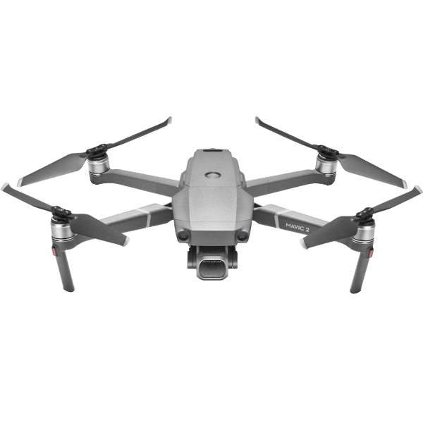
| DJI Mavic 2 Pro Drone | |
|---|---|
| Location: | Lab. 1.86 Building 7 |
| Manager: | Susana Costas |
| Operator: | User |
| Operating Principle: | Remote Control Drone |
| Manufacturer: | DJI |
| Model: | Mavic 2 Pro |
| Type: | Drone |
| Website: | DJI |
DJI Mavic 2 drone, designed for aerial image and video acquisition in research, environmental monitoring, surveying, and documentation of areas of interest. The equipment combines an autonomous and stabilized flight system with a high-resolution camera mounted on a three-axis gimbal, enabling the acquisition of stable and detailed aerial imagery.
The system allows for programmed flights and surveying operations across different types of terrain and environments, making it suitable for monitoring coastal areas, habitats, water bodies, vegetation, and infrastructure, as well as for visual documentation and the acquisition of georeferenced data when used in conjunction with GNSS systems and appropriate processing software.
This equipment may only be operated by a responsible person licensed to pilot drones.
Main Applications
- Environmental and coastal monitorization;
- Study area survey and documentation;
- Aerial image acquisition;
- Vegetation and habitat monitoring;
- Area and infrastructure visual inspection;
- Map and orthophotography production by overlaping images;
- Environmental alteration timeline monitoring;
Main Advantages:
- High mobility and ease of transport;
- Camera stabilized by a 3-axis gimbal;
- High resolution image and video acquisition;
- Stable flight system and pilot assistance functionalities;
- Obstacle detection sensors, depending on flight direction;
- Possibility of automated flights;
- Adequate for extensive area surveying;
- Image use for photogrametry and cartography;
- GNSS coordenates integration for support and georeferencing
Technical Specifications:
| Specification | Value |
|---|---|
| Manufacturer | DJI |
| Model | Mavic 2 Pro |
| Weight | 907 g |
| Dimensions | Closed: 21.4x9.1x8.4 cm Open: 32.2x24.2x8.4 cm |
| Diagonal Distance | 35.4 cm |
| Max. Ascent Speed | 5 m/s (S-mode) 4 m/s (P-mode) |
| Max. Descent Speed | 3 m/s |
| Maximum Speed | 72 k/h |
| GNSS | GPS+GLONASS |
| Camera - Sensor | 1" CMOS; Effective pixels:20 million |
| Lens | FOV: 77° 35 mm Aperture f/2.8-f/11 |
| Image Resolution | 5472×3648 |
| Video Resolution | 4K: 3840×2160 24/25/30p 2.7K: 2688x1512 24/25/30/48/50/60p FHD: 1920×1080 24/25/30/48/50/60/120p |
| Image Format | JPEG / DMG (RAW) |
| Video Format | MP4 / MOV (MPEG-4 AVC/H-264, HVEC/H.265) |